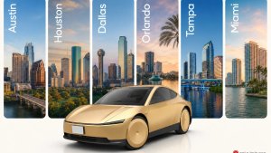
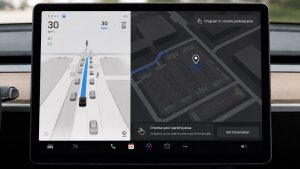
The Robotaxi service areas Tesla shows on its maps don’t tell the whole story. Just because a neighborhood falls inside the geofence doesn’t mean you can actually get picked up or dropped off there.
Tesla enthusiast Koby Pierce (@koby_pierce) has been mapping where the Robotaxi app actually lets you request pickups and drop-offs, and he’s finished all four of Tesla’s Texas markets. His method uses emulators running the Robotaxi app to request pickups and drop-offs across each service area and record which spots are available.
The results show that the usable areas are 22% to 41% smaller than the advertised geofences, though they still cover most of the people living inside the boundaries.
City | Advertised Area | Real Usable Area | Share of Advertised Area That’s Usable |
|---|---|---|---|
Austin | 273 sq. miles | 160 sq. miles | 59% |
Houston | 255 sq. miles | 188 sq. miles | 74% |
Fort Worth | 144 sq. miles | 105 sq. miles | 73% |
Dallas | 81 sq. miles | 63 sq. miles | 78% |
Austin: 160 sq. Miles
Austin has the biggest gap. Its real pickup and drop-off area is about 160 sq. miles, roughly 41% smaller than the 273 sq. miles Tesla advertises. Most of the missing coverage is on the east side of town, while central Austin, Downtown, Hyde Park, Mueller, and South Congress are almost fully covered. Austin-Bergstrom International Airport, Giga Texas, and the University of Texas campus are also off-limits for pickups.

Even with that gap, about 675,000 of the roughly 809,000 people living inside the advertised area, or 83%, are inside the real served area.
Dallas: 63 sq. Miles
Dallas has the tightest match. Its usable area is about 63 sq. miles of the advertised 81, or roughly 78% of the land. It covers about 89% of residents, around 337,000 of 381,000 people.

Most of the gaps in Dallas are small. Love Field airport is a no-go zone, and a 4.6-sq.-mile stretch of the Trinity River floodplain counts toward the area even though there’s nowhere to stop there. Pierce also mapped the area’s railroads, which include about 80 miles of track, 33 miles of light rail, and 199 street-level crossings. He found they affect coverage in some spots, but not by much overall.
Houston: 188 sq. Miles
Houston’s usable zone is about 188 sq. miles, which is around 26% smaller than the advertised 255 sq. miles. Houston recently grew to nearly 10x its original size, and most of the gaps are on its eastern edge near Downtown and in the far south.

Railroads seem to play a bigger role here. When Pierce laid the city’s 143 miles of rail track over the map, the gaps lined up closely with the tracks. He said Houston is the only city he’s tested where Tesla seems to be avoiding railroads that heavily.

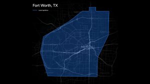
Fort Worth: 105 sq. Miles
Tesla’s newest market, Fort Worth, has about 105 sq. miles of usable area out of the advertised 144, or about 73% coverage. Meacham Airport and Naval Air Station Fort Worth are no-go zones, while Downtown, the Stockyards, TCU, and the Cultural District are covered.

What the Maps Show
Pierce’s biggest takeaway is that Tesla’s usable zones cover a larger share of residents than of land. Many of the uncovered spots are parks, wooded areas, fields, industrial zones, and other places where fewer people live. Some of them, like parks without roads, would never have pickup spots anyway, but the coverage share and maps don’t account for that (yet).
All of this suggests a pattern for how Tesla rolls out new cities, prioritizing where people actually live and travel rather than every block inside the boundary. Pierce said coverage has been improving with each new city Tesla launches.

For the advertised sizes of every market, including Florida and the Bay Area, check out our full guide to Tesla’s Robotaxi geofences.
More Validation Coming
Pierce plans to map Tesla’s Florida geofences next, along with Waymo’s service areas. He’s also building a website where riders can explore the real usable zones with overlays for crime rates, railroads, and population.
Tesla is also improving the Robotaxi service in other ways. It recently extended Robotaxi hours in Austin to 2 a.m. and added a Calm Mode that removes distractions from the touchscreen for a more relaxing ride. Tesla has also named Las Vegas, Phoenix, Jacksonville, and San Antonio as its next Robotaxi cities. As those markets launch and existing ones grow, the gaps between advertised and real coverage should keep shrinking.
Follow Us on Google
Add Not a Tesla App as a preferred source on Google to see more of our stories in Top Stories.
Add to Preferred Sources